Hydrometeorological Monitoring
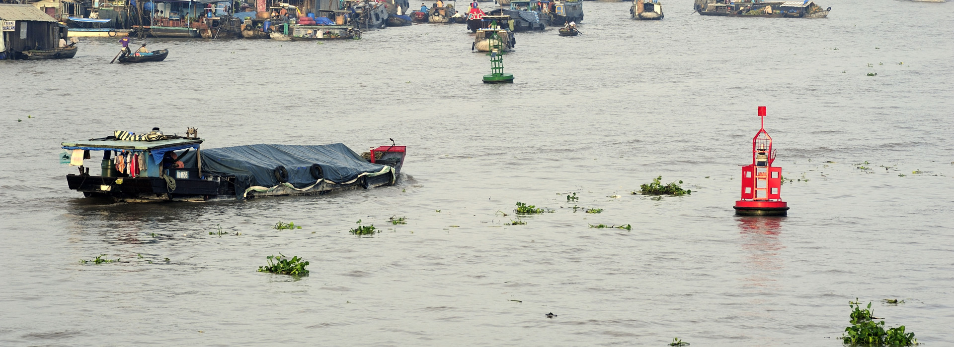
As the longest river in Southeast Asia, the Mekong River has a total runoff of about 475,000 million cubic metres. The headwaters of the Mekong, known as the Lancang in China, flow for nearly 800 km in Tibet before entering Yunnan province, where the river runs in a southerly direction into Myanmar, Lao PDR, Thailand, Cambodia, and Viet Nam before flowing into the South China Sea.
Various processes characterise the natural hydrological regime of the Mekong River. The two main processes are the southwest monsoon between May and November, which is the main driver of the river’s annual flood pulse, and individual storm events that pour intense rainfall over the Lower Mekong River Basin (LMB). These climate characteristics generate distinct peaks to wet season flows.
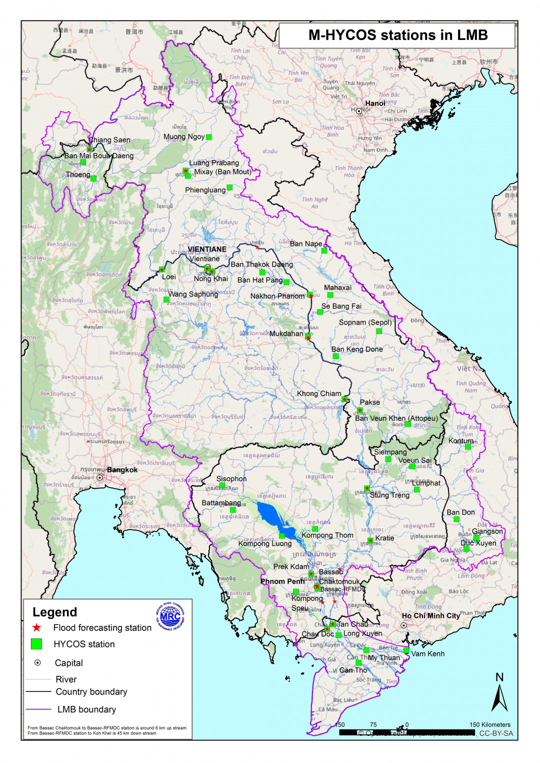
Recorded water levels at key stations explain hydrological flow regimes: at Chiang Saen to capture mainstream flows entering from the Upper Mekong River Basin; at Vientiane to show flows generated by climate conditions in the upper part of the LMB; at Pakse to investigate flows influenced by inflows from the Mekong tributaries; at Kratie to capture overall flows of the Mekong Basin, and at Tan Chau and Chau Doc to monitor flows to the Viet Nam Delta.

Changes in flows are brought about by rainfall patterns, human activities, upstream hydropower operations, extensive land use, deforestation, climate change, and the encroachment of natural floodplains and wetlands.
According to the World Bank, hydrological and meteorological hazards such as storms, floods, and droughts, are responsible for 90% of natural disaster losses worldwide. With continued population growth, rapid urbanisation and climate change, losses are projected to increase. To enable communities to prepare for and mitigate potential disaster events, it is imperative that information systems (IS) provide the data necessary to create accurate forecasts and communicate timely.
The hydrometeorological monitoring initiative plays a unique role, providing near real-time weather, water, early warning, and climate information products. This range of information is a core need for water resources development and management.
MRC Interventions
Hydrologic monitoring of the LMB has been a significant focus for the MRC and its Member Countries since the Mekong Committee was established in 1957. There are 690 hydromet stations along the Mekong River, of which 570 are rainfall stations. However, not all stations have up-to-date data.
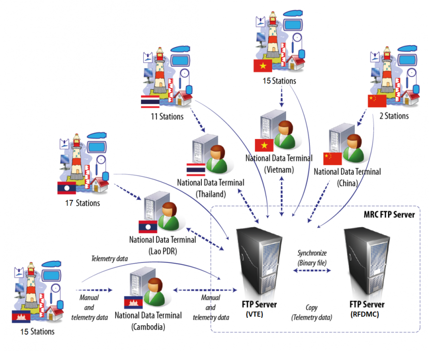
Since 2008, the data, such as water level and rainfall, have been collected through 49 automatic hydro-met stations located on the Mekong mainstream and tributaries. The hydro-met stations were established under under the Mekong Hydrological Cycle Observing System Project, known as the Mekong-HYCOS project, implemented by the MRC, from 2008-2012, in collaboration with the World Meteorological Organization (WMO) and funded by the French Development Agency (AFD) and French Global Environmental Fund (FFEM).
These 49 stations include 12 stations each in Cambodia, Lao PDR and Viet Nam, 11 in Thailand and two in southern in China. However, China no longer uses the HYCOS equipment, but rather submits one-hour interval measurements once a day during the agreed flood season period. Furthermore, two tidal stations in the Viet Nam Delta stopped operating due to challenging physical conditions and have since been withdrawn from the MRC-HYCOS network. So, currently there are 45 HYCOS stations.
The stations are equipped with telemetry systems to transmit near real-time water level and rainfall data in 15-minute intervals to a central database at the MRC Secretariat and respective line agencies in each Member Country. The network includes flood season data manually shared by the Member Countries, and by China for its two stations on the upper Mekong as part of a data-sharing agreement initiated in 2002.
In 2018, through the Japan-ASEAN Integration Fund (JAIF), 13 drought telemetric stations were built and upgraded for drought monitoring. Three stations are located in Cambodia, five in Lao PDR, and five in Viet Nam.
The MRC and Member Countries are continuously working on expanding the hydro-meteorological network.
With the improved hydrometeorological information system, the Member Countries can access accurate, reliable hydrologic data along the length of the river, from the upper Mekong in China to the Delta in Viet Nam.
The system is integrated into the existing MRC monitoring system which helps improve river monitoring and forecasting capacity.
Contribution to Basin and National Planning
The data provided by the MRC hydrometeorological network contributes to national and regional planning as well as to the implementation of MRC activities. The near real-time hydrometeorological monitoring is published online.
Key Events Relating to the Mekong-HYCOS
Phase I
Project setup and stations installed
End of phase I
- 49 stations fully equipped and operational
- 17 stations under the Appropriate Hydrological Network Improvement project upgraded
Phase II started
- Existing stations maintained and upgraded
- Helpdesk services established (email notification and monitoring website)
- Data usage improved (statistical tools)
Phase II continued
- Inspection missions conducted on stations that were not fully operational
- Field maintenance and fixing of existing stations carried out
Finalise station list for expansion
- 5 new stations proposed and 6 stations to be upgraded
- Civil works for new/upgraded stations conducted